
|
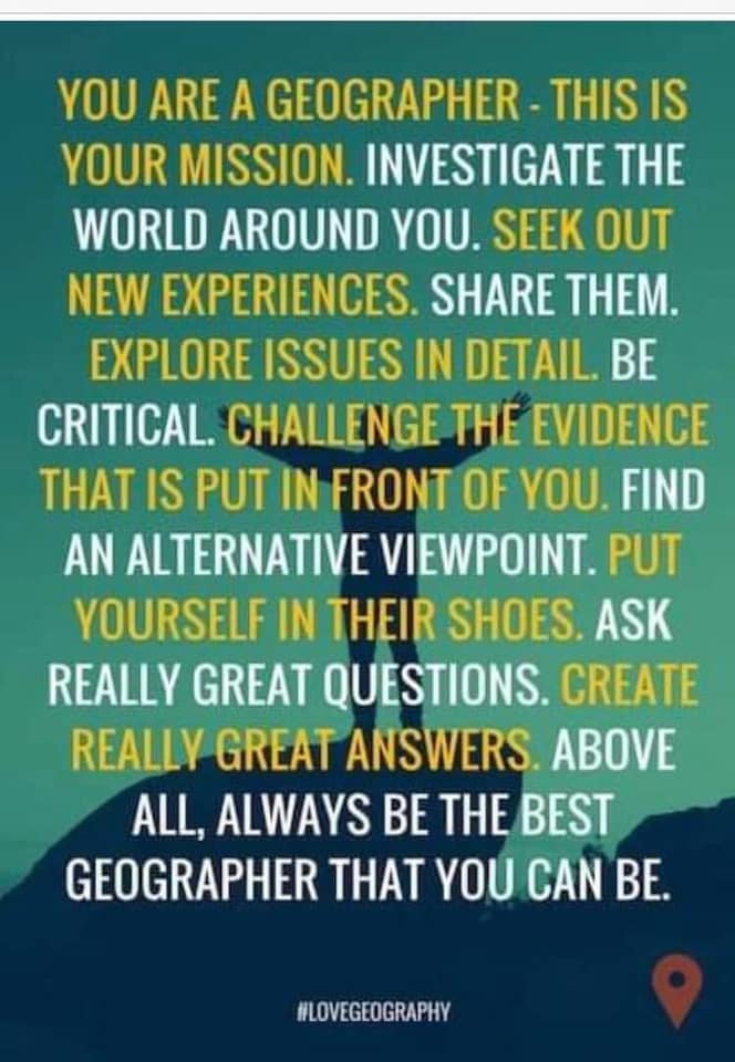
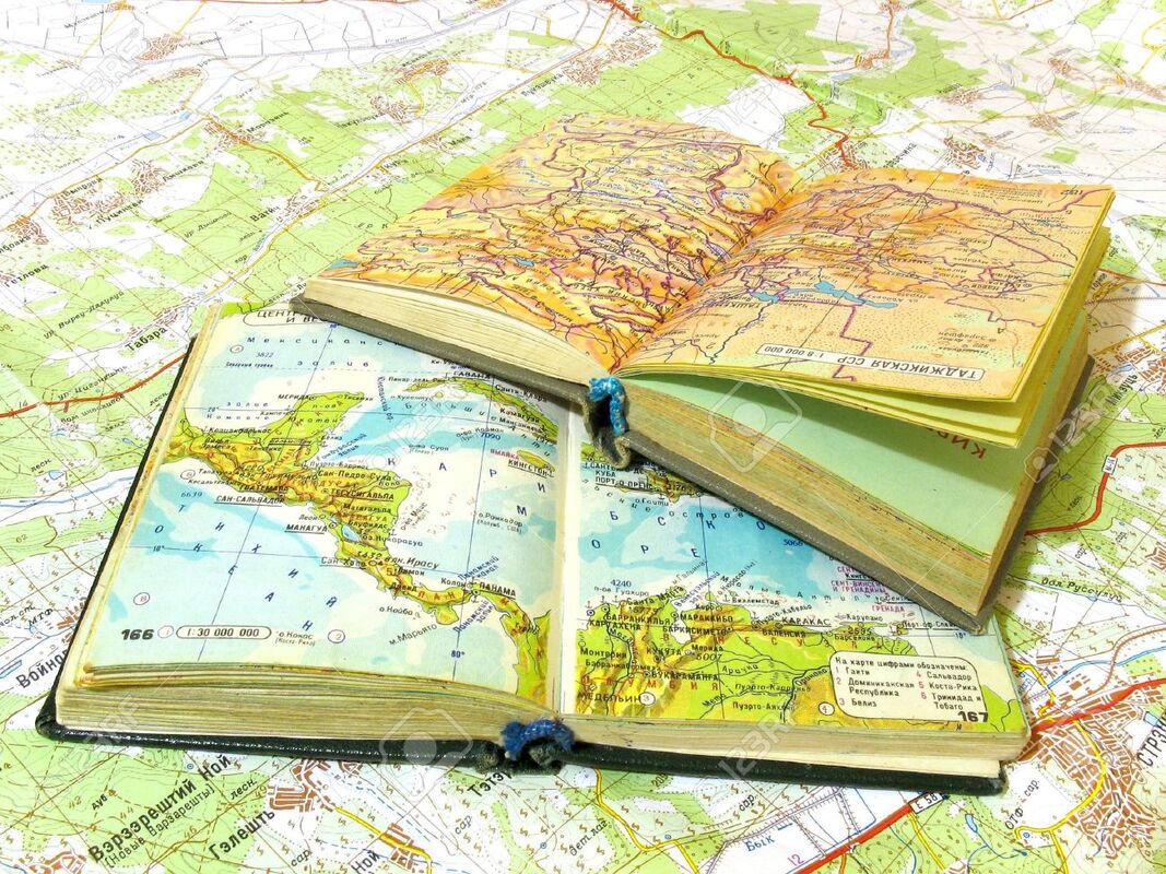
In this unit we will learn all about Geography and what it's used for. We will learn about continents, oceans and countries and how to use an atlas/map. This will help us in the future!
The lessons covered in this unit are: 1. What is Geography? 2. Parts of Geography 3. Continents and oceans 4. Lines of latitude and longitude |
1. WHY IS GEOGRAPHY IS IMPORTANT?
|
🡺 I can explain why geography is important.
Geography is about people and places. It helps us understand our world and makes it a more interesting place in which to live. It helps us make sense of news events and what is going on around us. As you will see, one of the best ways to learn about geography is to ask questions. Learning to ask questions will help you find out things for yourself and make your own decisions. The knowledge and skills that you learn in geography can open the door to a variety of interesting and exciting careers too. Jobs in travel, town and travel planning, weather forecasting, mapping, journalism, and the environment are just some of these. Geography helps you:
|
|
Geo-check!

1.Make a list of careers where the knowledge and skills that you learn in geography will be helpful. (This image below will help you!)
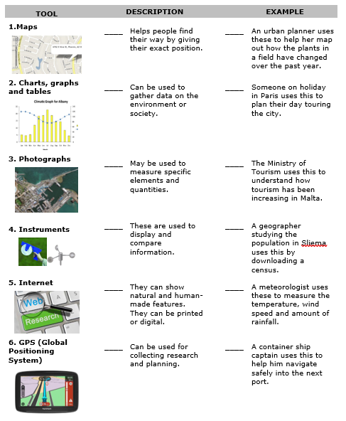
2. Make a list of the ways which geography will help you in your everyday life. 3. Geographers use specialized tools to describe, understand and explain the structure of the Earth. Match the tool with the description and an example of how it is used. This is the table on the right |
|
2. PARTS OF GEOGRAPHY
|
🡺 I can distinguish between physical and human geography.
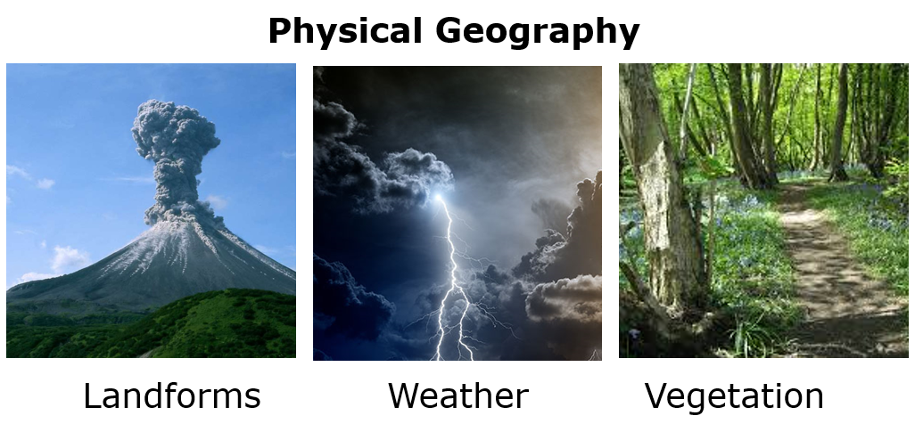
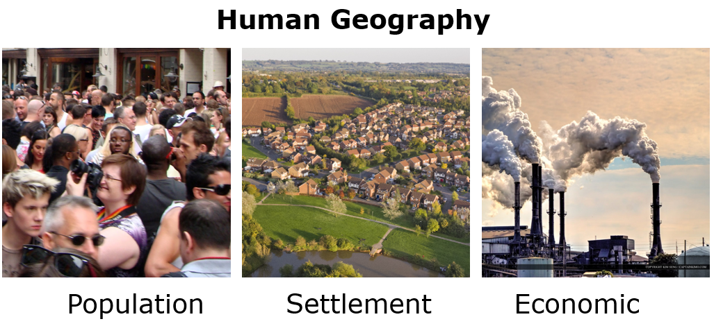
Geography can be divided into two main parts: Physical and Human Geography. Physical Geography is the study of the earth’s natural features. It is about the land, the sea and the atmosphere around us. Changes in temperature, rainfall, wind and pressure give us our weather and climate. Climate changes between seasons and from year to year. Different parts of the world have different climates. Landforms are natural features formed by river, the sea, ice and volcanoes. These are constantly changing as they are worn away in some places and built up in others. The earth’s surface is made up of many kinds of rocks which break into pieces and for soil. Plants grow in this soil and cover most of the earth’s land surface as vegetation. Human Geography is the study of where and how people live. Population geography looks at the distribution of people over the earth’s surface and why they live in certain areas. It studies places where the population is growing rapidly and problems that come with population growth. It looks at why people migrate from one place to another and its effects. Settlement geography is about where people live and how these places grow. Economic geography looks at how people earn a living and is about industry, jobs and wealth. When we look at a landscape we can see many different parts to do with physical and human geography! |
Click on the image above to practice the difference between physical and human geography!
|
Geo-check!
|
1. Write the correct term to fill in the sentences below.
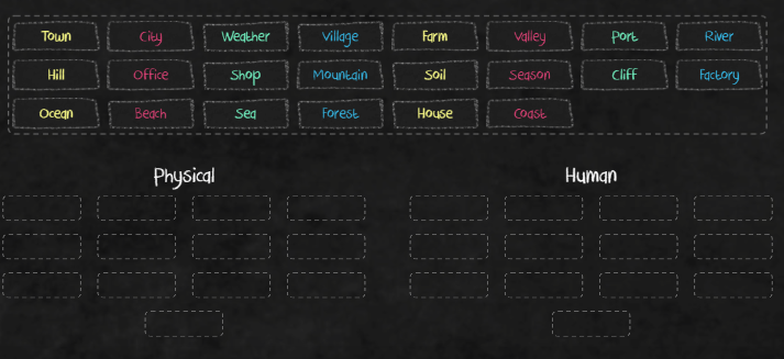
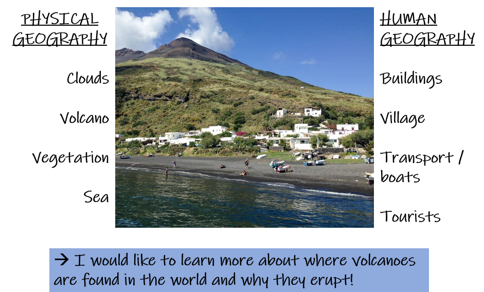
2. Draw a mind map below with at least 15 terms related to Geography. 3. On the above mind map, highlight the terms that are related mostly to HUMAN geography. 4. Find a photo on a magazine or online and stick it below. Label at least FOUR things that are related to Human Geography and another FOUR things that are related to Physical Geography. (Example on the right) 5. Choose ONE thing in the photo above that you would like to learn more about. Explain why. |
|
3. CONTINENTS AND OCEANS
|
🡺 I can use different sources to distinguish between a country, continents and oceans.
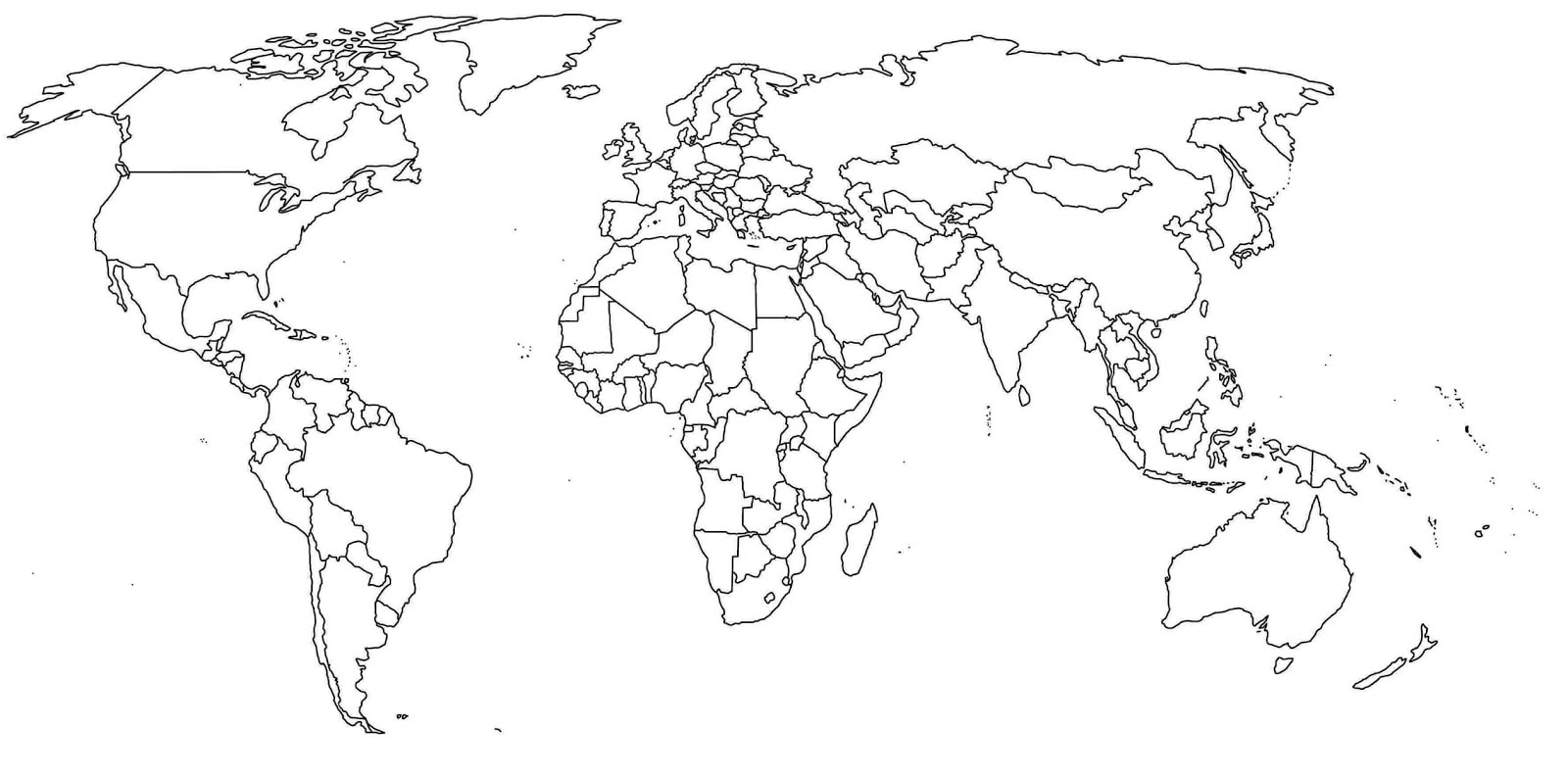
🡺 I can name all the continents and oceans. A globe shows where there is land and sea on Earth. An atlas will help us look at some countries, the continents and oceans. Earth has five major oceans, which are surrounded by land. A continent is a large area of land. There are seven continents on Earth. We live in the continent of Europe. Europe is one of the world’s smaller continents. Continents contain many different countries such as Malta, Italy and France. 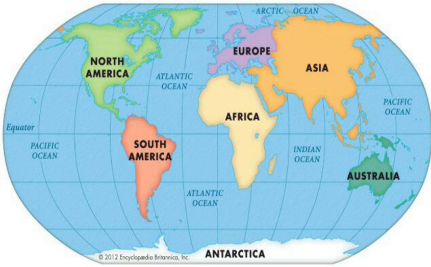
Continents and Oceans
|
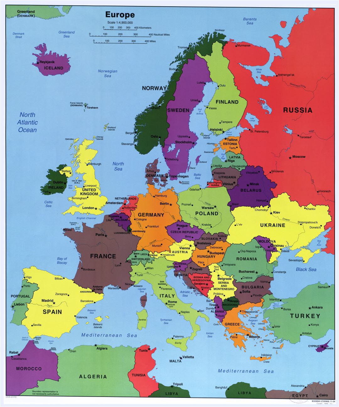
Countries in the continent of Europe
|

Geo-check!
|
Use your atlas to answer the following questions.
1. Write down the name of the ocean that touches these countries:
2. People live in only six of the seven continents. No one lives in Antarctica. Why? 3. Mark Malta on the map here. 4. Write down THREE countries found in each continent. 5. Mark these countries on the map overleaf. 6. Try to identify the following places from the following clues.
7. Listen to the news for a few days. List FOUR countries that are mentioned in the news. These news stories should have a geographical element within them. Write down the main point of each of these news stories (Think about volcanoes, earthquakes, floods, migration, conferences….) COUNTRY - REASON IT WAS MENTIONED IN THE NEWS |
|
4. LINES OF LATITUDE AND LONGITUDE
|
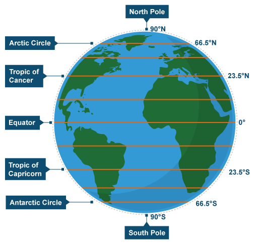
🡺 I can identify and name the poles and the major lines of latitude and longitude (Equator, the two tropics, Arctic and Antarctic Circles, Prime Meridian and International Date Line).
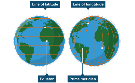
Lines of latitude and longitude are used to locate places accurately on the Earth's surface. Lines of Latitude Lines of latitude circle the Earth in an east-west direction. They are parallel to each other and all different lengths. The most important lines of latitude can be seen in this diagram. Lines of Longitude Lines of longitude run from the top of the Earth to the bottom. They are not parallel as lines of latitude are – they meet at a point at the north and south poles. They divide the Earth into segments, like an orange. The line which runs through Greenwich in London is called the Greenwich Meridian or Prime Meridian. The Prime Meridian is 0° longitude. |
|
Geo-check!
1. Draw two diagrams, one showing the earth with lines of latitude and another showing the lines of longitude. Also label the Equator and the Prime Meridian.
2/3. Using an atlas, find each line of latitude and write down these for EACH line of latitude:
4. The Prime Meridian passes through the continents of Europe and Africa. Name the countries it passes through.
5. The International Date line does not pass through any countries. Mention the ocean it passes through, and FOUR countries that are very close to it.
»» SOLVE IT!
There are 24 lines of longitude. How many degrees are there between each two lines of longitude?
2/3. Using an atlas, find each line of latitude and write down these for EACH line of latitude:
- a continent
- ocean
- country
- climate in the table above (e.g. hot, dry, wet, cold, freezing, icy, warm, mild …)
4. The Prime Meridian passes through the continents of Europe and Africa. Name the countries it passes through.
5. The International Date line does not pass through any countries. Mention the ocean it passes through, and FOUR countries that are very close to it.
»» SOLVE IT!
There are 24 lines of longitude. How many degrees are there between each two lines of longitude?
