NOTE: This is PART 2 of this unit.
PART 1 covers settlement site, function, hierarchy and shape. These are lessons 1 - 4. |
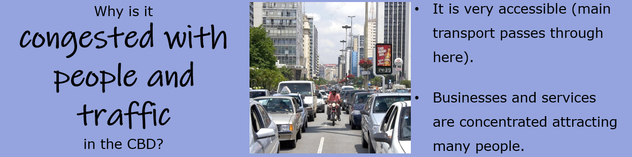
Why are there so many shops in the city center? Why are there skyscrapers in the city center and not on the outskirts? What is a land use model? Why are larger houses in the outer city cheaper than smaller houses in the city center? Who wants to build on the rural urban fringe and why?
The lessons covered in PART 2 of this unit are: 5. The CBD 6. The Inner City 7. The residential suburbs 8. Urban Land Use Models 9. Changes in the CBD 10. Changes in the Inner City 11. The rural-urban fringe 12. Brownfield and Greenfield sites 13. Problems of urban transport 14. Solutions of urban transport. |
5. THE CBD
|
🡺 I can define the main characteristics of the CBD namely its centrality, accessibility, high density of services and traffic, and high land value.
|
|


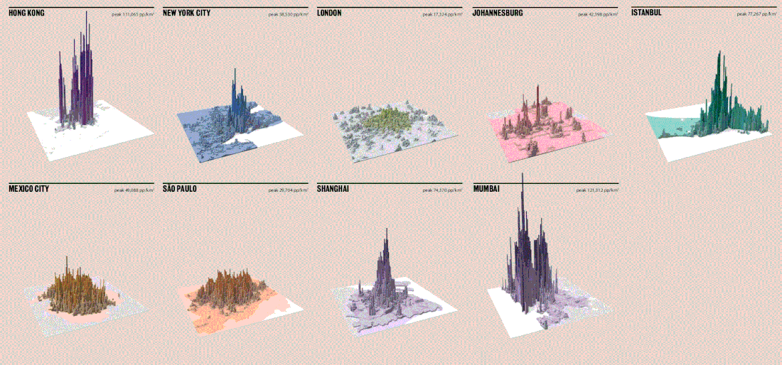
These maps show the density of people in these cities. The taller spikes represent larger concentrations of people, while the flatter zones represent lower density concentrations. You can Easily see that the CBD has the highest concentration of people.
Geo-check!
|
1. Answer the following questions briefly about the CBD.
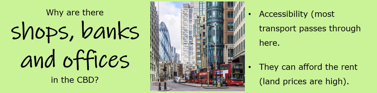
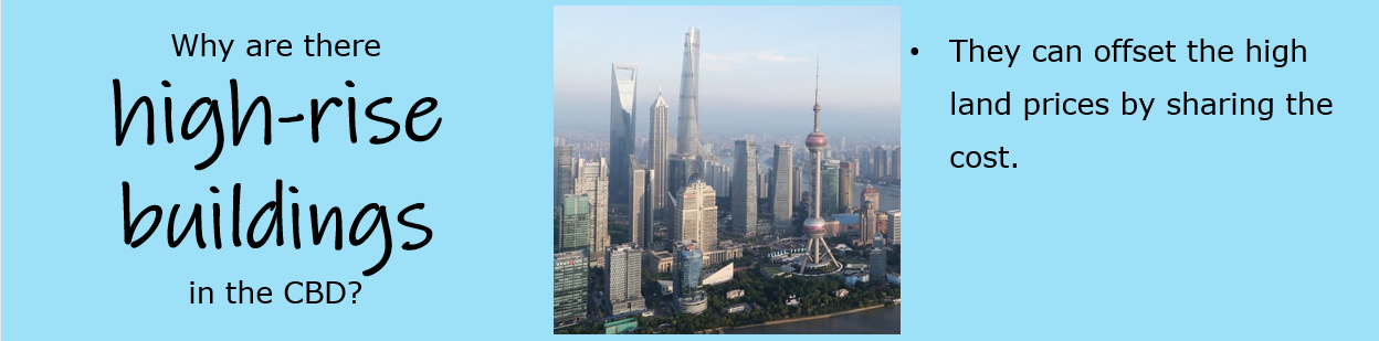
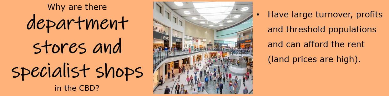
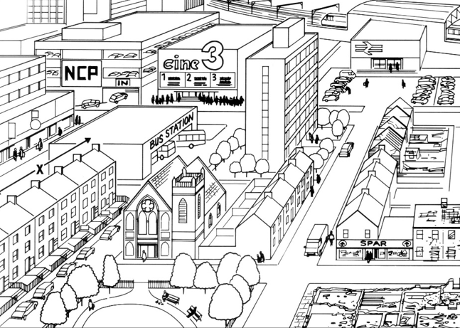
a. Where is the CBD usually located? b. Explain why it has such a location. c. List the major land uses found in the CBD. d. Why do you think that these land users are located here? e. Explain why compared with other zones the CBD has few people and industry located there. f. Explain why multistorey buildings dominate the CBD especially in North American and European cities. 2. Study the sketch below showing part of the central area of a town. a. Look for three pieces of evidence that show that this area is easy to reach by different forms of transport. b. The top left part of sketch A shows part of the CBD. List some functions one would expect to find in a CBD. c. Give one reason to explain why the CBD is a good location for the functions you named. d. There is a row of old terraced houses labelled X. These have all been converted to offices for small firms. Why do you think the people who used to live here wanted to move away from this area? e. Why do you think this is a good place for firms to have their offices? f. Describe the main characteristics of the CBD. g. Why is it often easy to spot the CBD on a photo of a city? h. Name two land uses that cover large areas in other urban zones but are missing in CBD. i. Explain why these land uses are absent from the city centres. |
|

6. THE INNER CITY
|
🡺 I can define the main characteristics of the Inner City including its location next to the CBD, crowded high density terraced housing, narrow unplanned streets, large old abandoned factories, railway stations, and polluted canals.
OLD INNER-CITY AREAS
In the 19th century:
Over the years, attempts were made to improve living conditions by
INDUSTRY Inner cities were large factories built during the industrial revolution and located:
Since then, many factories have been forced to close due to:
OTHER TYPES OF LAND USE
|
|


Geo-check!
|
1. Fill in the blank spaces below to explain how the inner city grew around the edge of the Central Business District.
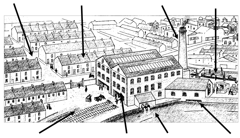
[Housing / canals / 19th / rural / work / trasnsport /goods / centre] The Inner Cities grew rapidly in the ____________ century as industrial towns in the UK and other parts of Western Europe. Industry grew up on the nearest available land to the ____________ of towns, close to ____________, rivers and the railway which were important for transporting ____________ and providing water. As many workers moved from the surrounding ____________ areas into these growing towns, there was a demand for quick and cheap ____________ to be built. The housing grew up close to the industrial areas as there was no means of public ____________ and people needed to be close to ____________. 2. The drawing here shows the main features of the Inner City some 120 years ago. Label it with some of the main characteristics of the Inner City. |
|

7. THE RESIDENTIAL SUBURBS
|
🡺 I can define the main characteristics of the Residential Suburbs namely its location at the edge of the built up area, smarter appearance, more open space, more recent and larger houses, and small shopping centres.
SUBURBIA
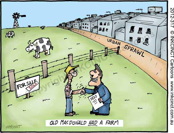
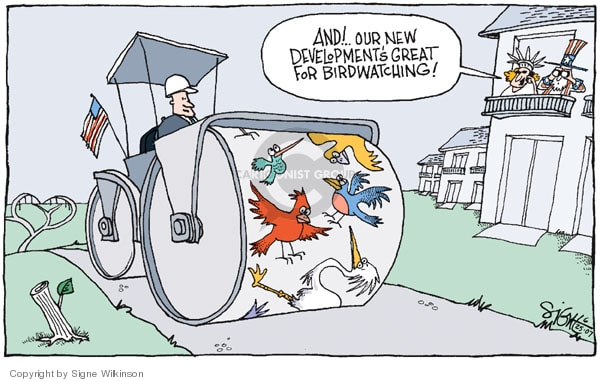
THE RURAL-URBAN FRINGE
- New industry or trading estates
ECONOMIC PRESSURES
ENVIRONMENTAL PRESSURES
|
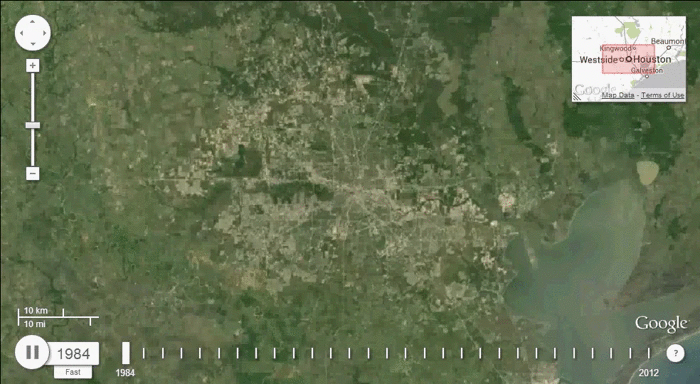

These two GIFs show urban sprawl. Look at how these cities have grown over time!
|


Geo-check!
1. Fill in the blank spaces below.
cars Semi-detached fringe workers factories suburbs buses sprawl countryside commute gardens larger
Since the beginning of the twentieth century, cities have spread outwards rapidly. Transport in the form of trams, then ___________ and much later ___________ meant that people could live further away from their place of work.
It led to the growth of the outer city or ___________. Suburbs are mainly residential, and in many urban areas of the UK they are dominated by ___________ and detached houses.
There is more space in the suburbs for ___________ houses, with bay windows, garages and front and back ___________ than in the inner city. In this way cities grew outwards unchecked taking up more and more of the surrounding ___________.
This outward growth of cities is known as urban ___________. As the distance from the CBD increased residents living in the suburbs had to travel or ___________ long distances to their place of work and for shopping. As the suburbs continue to grow outwards, the built-up area extends into the rural-urban ___________.
Some shopping centres, offices and ___________ also move to the edge of town, preferring to be nearer to customers and ___________.
2. Briefly explain the meaning of the following key words.
3. Give reasons why people prefer to live in the outer city rather than the inner city.
cars Semi-detached fringe workers factories suburbs buses sprawl countryside commute gardens larger
Since the beginning of the twentieth century, cities have spread outwards rapidly. Transport in the form of trams, then ___________ and much later ___________ meant that people could live further away from their place of work.
It led to the growth of the outer city or ___________. Suburbs are mainly residential, and in many urban areas of the UK they are dominated by ___________ and detached houses.
There is more space in the suburbs for ___________ houses, with bay windows, garages and front and back ___________ than in the inner city. In this way cities grew outwards unchecked taking up more and more of the surrounding ___________.
This outward growth of cities is known as urban ___________. As the distance from the CBD increased residents living in the suburbs had to travel or ___________ long distances to their place of work and for shopping. As the suburbs continue to grow outwards, the built-up area extends into the rural-urban ___________.
Some shopping centres, offices and ___________ also move to the edge of town, preferring to be nearer to customers and ___________.
2. Briefly explain the meaning of the following key words.
- suburbs
- urban sprawl
- rural-urban fringe
3. Give reasons why people prefer to live in the outer city rather than the inner city.

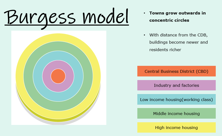
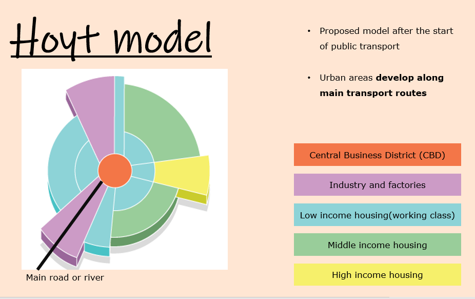
8. URBAN LAND USE MODELS
🡺 I can illustrate and interpret the two most important urban land use models by Burgess and Hoyt to include the CBD, Transitional, Twilight Zone and Modern Suburbia.
Urbanisation – an increase in the proportion of people living in towns and cities.
URBAN LAND USE MODELS
Models – a theoretical framework which may not actually exit but which helps to explain the reality.
Urbanisation – an increase in the proportion of people living in towns and cities.
- In the past, most people lived and worked in rural towns and villages.
- During the 1800s, there was a rapid growth of industry and large-scale urbanisation began in Europe and USA.
- After the 1900s, people continued to move to urban areas for:
- More and better paid jobs.
- Nearness to place of work and entertainment
- Better housing, services and shopping facilities.
URBAN LAND USE MODELS
Models – a theoretical framework which may not actually exit but which helps to explain the reality.
|
BUGRESS
|
HOYT
|
|
URBAN LAND USE AND FUNCTIONAL ZONES
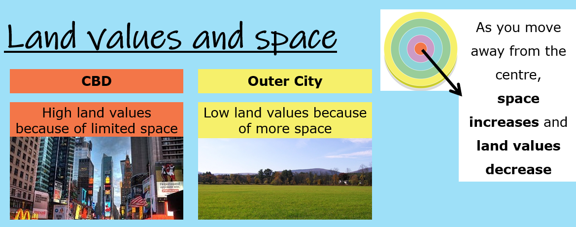
Highest in the CBD as spaces are limited and competition is greatest. Land values decreases rapidly away from the CBD as the amount of sites and space increases.
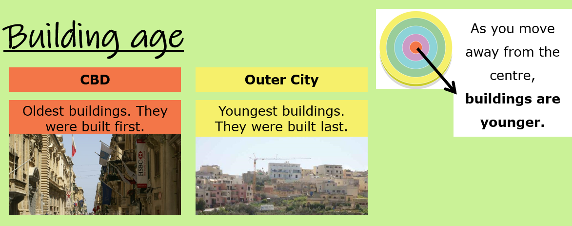
Towns developed outwards, so oldest buildings are near the CBD.Newest buildings at the outskirts.
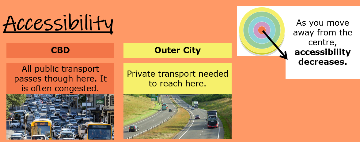
CDB is the easiest place to reach as all main routes from the outer regions meet here. Nowadays, there are problems with traffic.
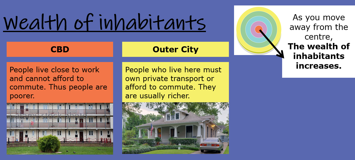
Poorer people live in cheaper housing near the CBD and inner city. They cannot afford transport to the CBD for work, so have to live closer.People living on the outskirts are richer - can afford to travel to the CBD for work. |
|
|
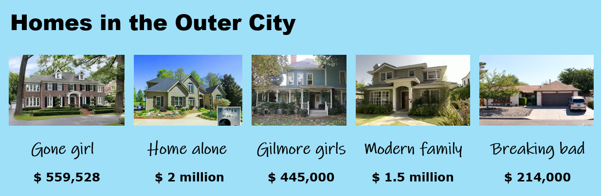
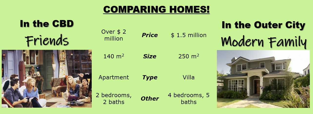
On the right you can see a video clip from the movie The Incredibles.
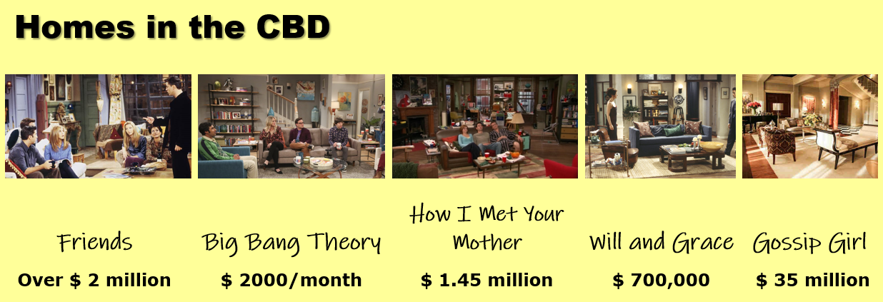
Below, you can compare different TV show houses. |
|
|
|
Geo-check!
1. Tick the terms that are correct about the Burgess Model.
a. The Central Business District is always found in the centre of towns.
b. This model was based on a study of land use in Manchester.
c. Burgess suggests that cities grow outwards from the CBD in a series of sectors.
d. The oldest part of the city is at the centre and the newest part on the outside edge.
e. The quality and size of houses increases with distance from the CBD.
f. The height of buildings tends to be greatest at the edge of the city.
g. Land-values are highest in the CBD and decrease as one moves out.
2. Match the following sentences to describe the model as suggested by Hoyt.
a. Hoyt proposed his model after the
b. According to Hoyt the CBD is still the area
c. He assumed that ‘like would attract like’ and that is why
d. Factories may be concentrated in one sector
f. The lowest class housing would be closest
g. High Class housing also form a sector of its own
_______to the industry
_______running all the way from the CBD to the outer suburbs
_______to form a zone of industry
_______land uses would concentrate to form sectors
_______development of public transport
_______with the highest land prices.
3. Describe the main differences between the two land uses models. Give two reasons to explain these differences.

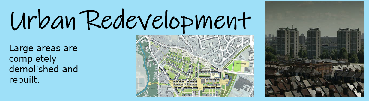
9. CHANGES IN THE CBD
🡺 I can list and explain the changes occurring in the CBD such as improvements in public transport and creation of pedestrian areas
|
20TH CENTURY LANDUSES IN THE CBD
Problems |
PROBLEMS OF THE CBD
|


|
THE NEED FOR CHANGE IN THE CBD
Solutions |
RECENT CHANGES
Pedestrianised zones:
Shopping malls:
There has been an increased demand for:
This has been achieved by more:
|


Geo-check!
|
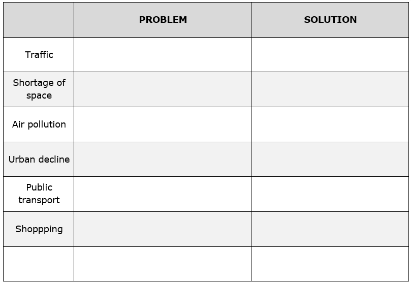
1. The CBDs of major cities are becoming busier and this is resulting in a number of problems. Fill in the second column with problems affecting the CBD and the ‘solution’ column with what has been done to reduce these problems in city centres.
|
|

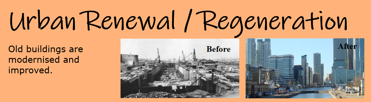
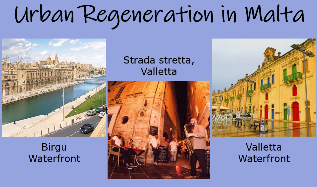
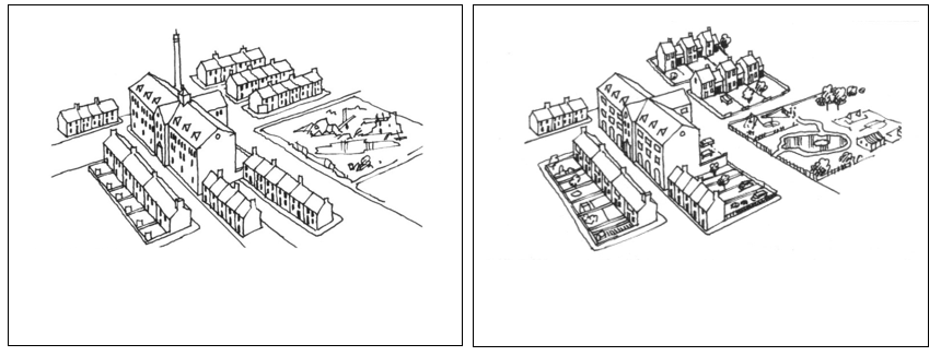
10. CHANGES IN THE INNER CITY
|
🡺 I can list and explain the changes occurring in the Inner City such as redevelopment of abandoned and derelict buildings or slum areas.
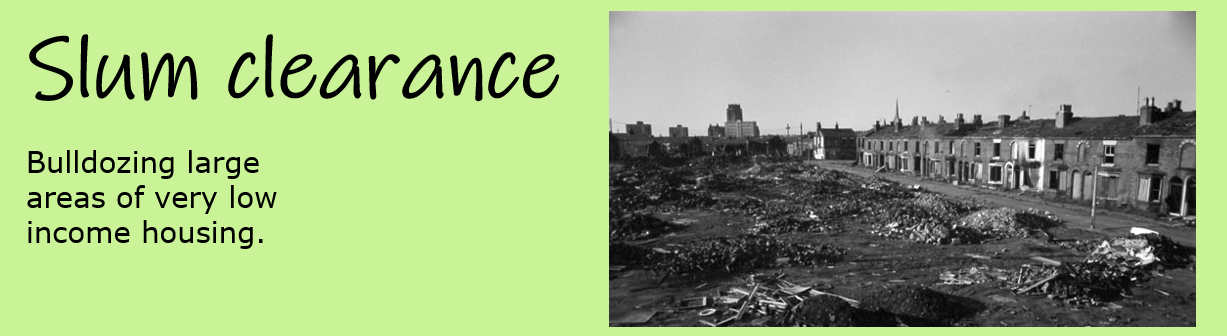
- Urban regeneration - Existing areas were improved
|
|
Geo-check!
|
1. List the main reasons for the closure of industries in the Inner City.
2. What was the ‘driving force’ behind the building of high rise flats in the 1960s? 3. Make a list of six problems the tenants living in these tower blocks had to face. Use your list to label the diagram. 4. Answer these questions explaining clearly why these multistorey tower blocks were built and why they proved unsuccessful. a. Why were they built? b. Why were they unsuccessful? 5. Diagram B shows an area after urban renovation has taken place. What changes have taken place to improve the quality of life for the people living in the Inner City. Explain how the inner city shown in the diagram has been transformed and improved through urban renovation or regeneration. |
|

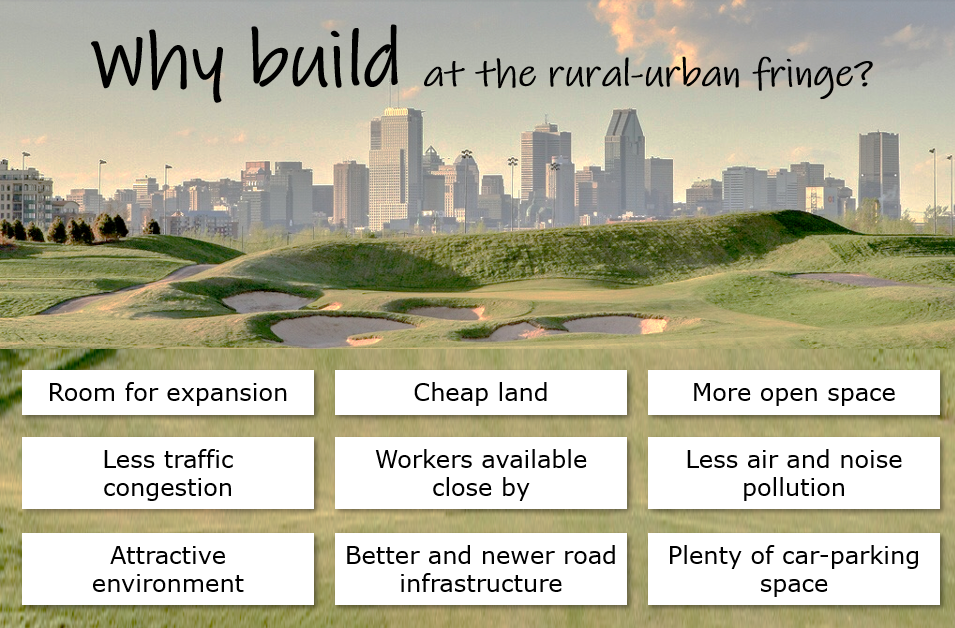
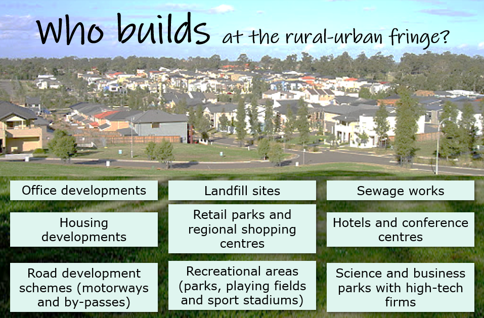
11. THE RURAL-URBAN FRINGE
|
🡺 I can list and explain the developments that are taking place at the Rural Urban Fringe such as out of town shopping centres and science and business parks.
🡺 I can explain the term urban sprawl and the measures taken to contain it by the use of green belts and green wedges. Green belts – an area of land around an urban are where the development of houses and other buildings was to be severely restricted where the open character of the countryside was to be preserved for farming and recreation. By the end of the 20th century there was increasing competition for land at the rural-urban fringe due to:
The rural-urban fringe is under constant threat for:
Advantages of out-of-town shopping centres
|

|
Geo-check!
11.1 What are the main reasons for such an increasing competition for the use of land at the rural urban fringe? (Finish these sentences)
a. Cheaper land that ...
b. More space that ...
c. Less traffic that ...
d. Less pollution that ...
e. Better road infrastructure that ...
f. Good access that ...
g. A pleasant environment that ...
h. Room for expansion that ...
i. Workers available close by that ...
2. What are the main landuses at the rural urban fringe?
3. Why is the rural-urban fringe considered as a zone of conflict?
4. Briefly explain why green belts and green wedges were set up.
5. Briefly explain how green belts and green wedges stop urban sprawl.

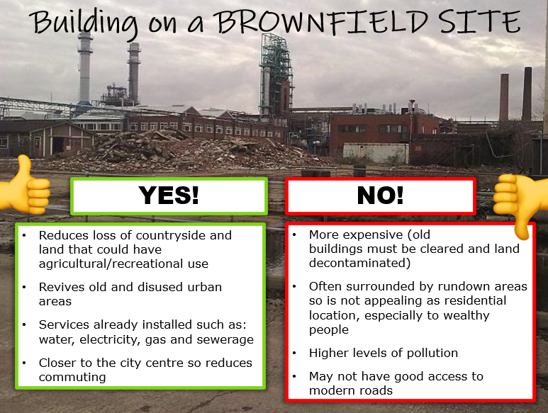
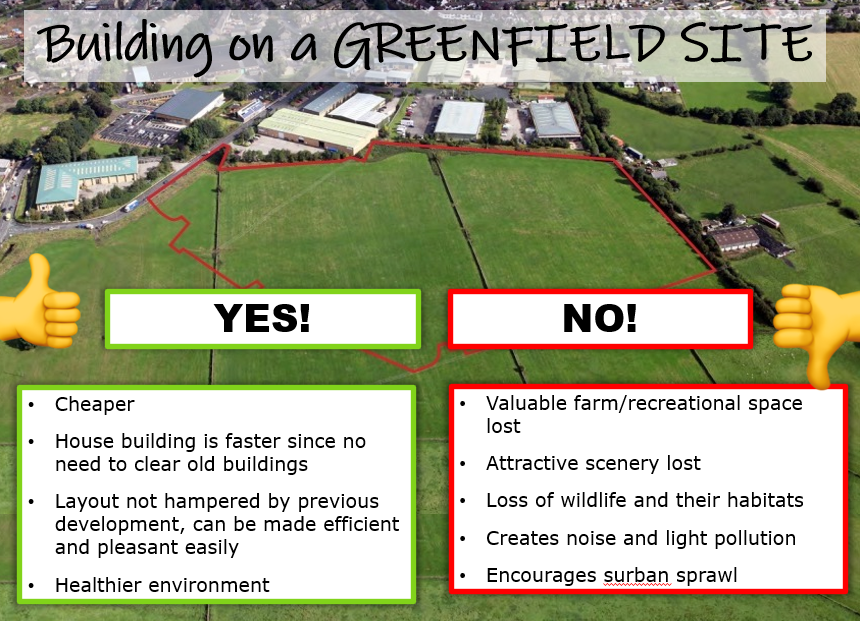
12. BROWNFIELD AND GREENFIELD SITES
|
🡺 I know the difference between brownfield and greenfield sites.
|
|
|
Brownfield sites
Disused and derelict land in existing urban areas Why build on a Brownfield site?
|
Greenfield sites
An area of countryside that has not been built upon. Why build on a Greenfield site?
|
Geo-check!
1. Briefly explain the difference between a brownfield site and a greenfield site. Do you think development should be mainly on brownfield sites or greenfield sites?
2. Why are greenfield sites on the rural-urban fringe attractive to developers?
3. What is the ‘urban-rural fringe’?
4. Give two examples of land uses which can typically be found in the urban-rural fringe.
5. Explain the disadvantages caused by developments locating in the urban-rural fringe.
2. Why are greenfield sites on the rural-urban fringe attractive to developers?
3. What is the ‘urban-rural fringe’?
4. Give two examples of land uses which can typically be found in the urban-rural fringe.
5. Explain the disadvantages caused by developments locating in the urban-rural fringe.

13. PROBLEMS OF URBAN TRANSPORT
|
🡺 I can explain the reasons for the increase in urban transport.
🡺 I can demonstrate the damaging effects of increased traffic in urban areas.
WHY HAS TRAFFIC INCREASED?
EFFECTS OF TRAFFIC Environmental
Economic
Social
|
|


Geo-check!
1. List the main reasons for the increase in traffic in urban areas.
2. At what time of the day do urban areas suffer severe traffic congestion. Explain why.
3. What is a commuter?
4. Draw a mind map of all the effects of traffic. It should have at least 8 statements.
2. At what time of the day do urban areas suffer severe traffic congestion. Explain why.
3. What is a commuter?
4. Draw a mind map of all the effects of traffic. It should have at least 8 statements.

14. SOLUTIONS OF URBAN TRANSPORT.
|
🡺 I can suggest ways to reduce the damaging effects of increased traffic.
|
|


Geo-check!
1. The following is a list of different schemes that have been implemented to lease traffic congestion in most cities. Match each description with the corresponding traffic symbol.
2. Make a list of other schemes that help to reduce the damaging effects of increased traffic in urban areas.
- The introduction of Park and Ride schemes around towns and cities – people park in car parks on the edge of a settlement and then catch regular buses to the centre.
- Pedestrianised areas and areas in the city are designated as pedestrian only zones.
- Permit holder parking – certain parts of the city, particularly near the centre is designated as permit parking only. This means that people must have a permit to park in that area. This reduces the number of people driving into towns and cities as parking opportunities are restricted.
- Car pooling – people are encouraged to share cars rather than drive to work alone
- Spaces for parking has been reduced in city centres and charges have been increased.
2. Make a list of other schemes that help to reduce the damaging effects of increased traffic in urban areas.

